Jakarta topographic map
You can find on this page the Jakarta topographic map to print and to download in PDF. The Jakarta elevation map present the topography, river and relief of Jakarta in Java - Indonesia.
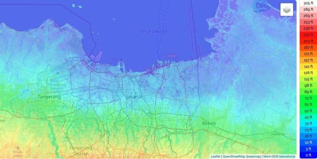
Jakarta elevation map
The Jakarta topographic map shows elevation, hills and landforms in Jakarta. This elevation map of Jakarta will allow you to know topography, river and relief of Jakarta in Java - Indonesia. The Jakarta topographic map is downloadable in PDF, printable and free.
Situated on the northwest coast of Java, at the mouth of the Ciliwung River on Jakarta Bay, Jakarta Special District has 662 km2 of land area and 6,977 km2 of sea area. Jakarta is located in a low, flat basin, elevation averaging 7 metres (23 ft) above sea level as you can see in Jakarta elevation map; 40% of Jakarta, particularly the northern areas, is below sea level, while the southern parts are comparatively hilly. Rivers flow from the Puncak highlands to the south of the city, across the city northwards towards the Java Sea; the most important is the Ciliwung River, other rivers are Pesanggrahan, and Sunter.